SparkyAI
In a paddy-growing village in Kerala, a cluster of 120 smallholder farmers cultivating ~180 acres regularly faces excess rainfall and waterlogging during the monsoon, leading to 10–20% yield loss due to poor tillering and root stress. Using SparkyAI, multi-temporal satellite imagery is analysed to identify waterlogged zones covering ~35–40% of the fields within the first 2–3 weeks of heavy rainfall. Farmers receive field-level advisories on drainage prioritization and irrigation avoidance. As a result, irrigation events are reduced by ~25%, crop uniformity improves, and yield stability increases by 12–15% in the same season. Similar applications in banana and coconut farms (5–10 acre plots) help detect moisture imbalance and nutrient stress early, reducing input wastage by 20–30% without using any on-ground sensors.
Website : https://sparkyai.in/
Current Status: Beta launched
Business Model: B2C
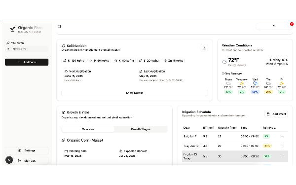
Product Description
SparkyAI is an AI-powered satellite imagery analytics platform tailored for high-rainfall, humid agro-climatic regions like Kerala. The product analyses multi-temporal satellite data to detect crop health variations, excess soil moisture, waterlogging risks, and nutrient stress—common challenges faced by farmers in the state. By converting complex geospatial signals into simple, actionable advisories, SparkyAI supports better irrigation planning, drainage management, and crop monitoring without requiring any on-ground hardware. The solution is deployed through an offline, community-driven model, making it suitable for small and marginal farmers operating in fragmented landholdings. SparkyAI enables climate-smart, data-driven agriculture aligned with Kerala’s sustainability and resilience priorities.